MODERN BOTANY - P. RAVEN - 1990
SECTION IX. ECOLOGY
CHAPTER 32. BIOMES
A biome is a climatically determined assemblage of terrestrial ecosystems featuring specific vegetation, across which Water, nutrients, and organisms—including humans—are exchanged. An individual biome covers a vast area of the Earth's surface, typically spanning multiple continents. Biomes can be classified in various ways, but the categories discussed in this book provide the most comprehensive Overview of the planet's vegetation.
Their distribution (Fig. 32-1) is governed by three primary types of physical factors: (1) global air Circulation, particularly the trajectories of moisture-bearing prevailing winds; (2) the distribution of solar heat and relative climatic seasonality; and (3) the global placement, elevation, and orientation of mountain systems. The interplay of these factors gives rise to the remarkable diversity of plant cover across the Earth's surface.
Life on Land
Terrestrial plants face a wide array of environmental challenges. In most regions, they contend with periodic drought, as well as rapid daily and seasonal Temperature fluctuations. They must survive unfavorable growing seasons, often rooted in substrates with a mineral composition far from optimal, and withstand the force of gravity (which affects land plants far more intensely than aquatic ones). However, life on land also offers distinct advantages: with the exception of high altitudes, atmospheric oxygen is distributed much more uniformly than in water, and Carbon dioxide is likewise more readily available.
Class="center">Fig. 32-1. Global distribution of biomes. This map was custom-designed specifically for this book. Due to its global scope, the scale is relatively small, and consequently, the outlines of the zones are generalized. It should be noted that the biomes shown are not uniform and encompass A wide variety of distinct plant communities. Boundaries between biomes may be abrupt, but far more often they are blurred, forming broad transitional zones.


The Earth's land surface is interrupted by seas and oceans, and this fragmentation exerts a profound influence on the dispersal of organisms. Furthermore, individual land areas vary dramatically in precipitation, substrate, climate, and other characteristics. Such variations mean that the geographic range of any terrestrial Organism is far more restricted than that of a marine organism of comparable size and mobility.
The Relationship Between Climate and Geographic Position
Plants and plant communities shift in response to environmental conditions. For instance, atmospheric temperature generally decreases with increasing latitude. In terms of annual averages, the hottest climate is not found at the equator, but rather at latitude 10° N; only in January is the equator warmer. In July, the warmest parallel is 20° N. In the Northern Hemisphere, mean annual temperatures are generally higher than in the Southern Hemisphere due to the presence of much larger landmasses. The mean annual temperature at the equator is 26.3°C, at latitude 40° N it is 14°C, and at latitude 40° S it is 12.4°C. Just as when moving from the equator northward or southward, cooling also occurs with increasing elevation. As a rule, A change in mean atmospheric temperature equivalent to a 1° shift in latitude occurs with an ascent of approximately 100 m. This plays a crucial role in the distribution of terrestrial organisms. For example, plants and animals characteristic of the Arctic can be found at the equator in high-altitude mountain regions, especially where mountain ranges extend far to the north and south (Fig. 32-3).
Fig. 32-3. A similar sequence of plant community transitions can be observed either by traveling hundreds of kilometers from south to north or simply by ascending high into the mountains. This parallelism with latitude was first noted by Alexander von Humboldt.
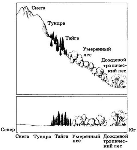
However, significant differences exist between high-latitude and high-altitude habitats. In the mountains, the air is thinner and solar radiation is more intense. Most of the atmospheric water vapor, which plays a primary role in preventing nighttime cooling of the ground, is concentrated below 2,000 m above sea level. Consequently, mountain nights are often much colder than lowland nights at the same latitude. Moreover, near the poles, day length and temperature regimes fluctuate dramatically throughout the year, whereas near the equator they remain relatively constant (Fig. 32-4). Therefore, "arctic" organisms that extend along mountain chains to the equator must develop physiological adaptations to cope with the differences between high-latitude (arctic) and high-altitude (alpine) environments.
Fig. 32-4. In tropical high-altitude regions, temperature varies little throughout the year, but night frosts can occur nightly. These unusual conditions have driven the evolutionary emergence of plants with bizarre growth forms, such as these giant espeletias (Espeletia grandiflora) of the aster family in Colombia. In these plants, the apical meristem is protected from freezing by tightly clustered apical leaves, the fleshy Structure OF THE entire plant, and a dense felt of light-reflecting silvery hairs. Such adaptations are especially crucial under the intense ultraviolet radiation of tropical mountains, which poses a severe hazard to Proteins and Nucleic Acids in the leaves.

Temperature regimes often vary substantially across different slopes of the same mountain range. In winter, for example, in the mid-latitudes of the Northern Hemisphere, south- and west-facing slopes are generally drier than north- and east-facing ones, because northern slopes receive no direct solar radiation, while eastern slopes receive it in the morning before the air has warmed up. Furthermore, in summer after midday, the sun heats the ground much more intensely than in the morning due to a decrease in atmospheric water vapor. As a result of the interaction between insolation and cloud cover in the Northern Hemisphere, the driest slopes typically face southwest. (And which slopes do you think are the driest in the mountains of the Southern Hemisphere?) For these same reasons, mosses and Lichens are more frequently found or better developed on the northeast side of trees in the Northern Hemisphere—a well-known natural compass for orientation in the forest. However, this pattern is clearly discernible only in sufficiently open, well-lit locations.
Due to the complex interplay of variable local conditions, the global distribution of biomes does not conform to the pattern one would expect if the Earth were a smooth sphere. Furthermore, major historical shifts in vegetation continue to influence its present-day appearance. Below, we examine Examples of how the interaction of climate, topography, and soil type determines the distribution of the 17 biomes we will discuss (see map in Fig. 32-1): rain forests, savannas, and tropical deciduous forests (including savannas, mixed subtropical forests, monsoon and mixed tropical forests, southern woodlands, and scrub1); deserts (including deserts, semideserts, and juniper savannas); grasslands; temperate deciduous forests; temperate mixed and coniferous forests (including west coast mixed forests, temperate mixed forests, alpine tundra, and montane forests); Mediterranean scrub; taiga; and arctic tundra (including arctic tundra and polar desert).
1 Scrub refers to thickets of sclerophyllous shrubs. — Ed. note.
Rain Forests
Tropical rain forests, dominated by broad-leaved evergreen trees, harbor more species of plants and animals than all other terrestrial biomes combined. At any time of year, neither water nor temperature acts as a limiting factor. Despite the vast number of species, the number of individuals of any single species is relatively low; within a hectare, a particular tree species may be represented by just a single specimen. Not only do tropical rain forests support a greater variety of organisms, but their interrelationships are also far more complex than in any other biome (Fig. 32-5).
Fig. 32-5. Tropical rain forest. A. Tree diversity, occasionally reaching several hundred species per hectare, is especially striking when individual plants come into bloom, such as this guaiacum tree (Tabebuia chrysantha) in Panama. B. A tree with buttress roots in a lowland forest of Thailand. C. The fungus Dictyophora duplicata. D. A dense cover of epiphytes on a tree in Colombia. E. An orchid growing on a mango trunk in Ecuador. F. Lianas, such as this hummingbird-pollinated passionflower (Passiflora coccinea), are abundant in tropical rain forests (G).
In such forests, very little light reaches the ground, and annual precipitation ranges from 200 to 400 cm. Organic litter accumulation is minimal. Decomposers rapidly break down fallen leaves, plant stems, and the remains of dead animals. The nutrients thus released are quickly absorbed by mycorrhizae or leached from the soil by heavy rains. Although monthly precipitation can vary significantly, there is no distinct dry season.
As a rule, tropical rain forest plants lack specialized adaptations for surviving unfavorable dry or cold seasons. The overwhelming majority of species are trees, accompanied by abundant woody lianas. The flora is exceptionally rich in epiphytes, which grow on trees in the well-lit zone high above the ground. Lacking direct contact with the soil, they obtain water from the humid air of the forest canopy and directly from rainfall, while drawing mineral nutrients from dust and the surfaces of their host plants. Alongside epiphytes and lianas, numerous animal species inhabit the tree crowns; it is precisely in this stratum of the tropical rain forest that the fauna is most abundant and diverse.
Due to the dim light conditions on the forest floor, herbaceous plants are extremely scarce here, and those that do exist are concentrated mainly in natural light gaps within the closed canopy. Tropical rain forest trees are generally taller than those in temperate regions, frequently reaching 40 to 60 m in height. Moreover, they exhibit remarkable diversity; it is rare to find fewer than 40 tree species per hectare, whereas in temperate forests this number is typically quite low. Nonetheless, tropical rain forests appear remarkably uniform from the outside. The trees usually branch only high above the ground. Because their roots typically do not penetrate deeply into the soil, they are often buttressed at the Base of the trunk, providing rigid and expansive support. The leaves are medium-sized, leathery, and dark green; the bark is thin and smooth; and the flowers are generally inconspicuous, with greenish or whitish hues. Such forests often form multiple canopy layers: the lower strata consist of the understory of taller trees and a relatively small number of short-stature species.
There are three main global regions where tropical rain forests are distributed. The most extensive of these is the Amazon basin in South America, with extensions reaching the coast of Brazil, Central America, eastern Mexico, and several Caribbean islands. In Africa, a major expanse of rain forest is located in the Zaire basin, from which this biome extends to the western coast of Liberia. A third rain forest region stretches from Sri Lanka and eastern India to Thailand, the Philippines, Indonesia, and New Guinea, also encompassing a narrow strip of the northeastern coast of Australia (see Fig. 32-1). In North America,
tropical rain forests occur only in southern Mexico, as well as on Puerto Rico and in the northern part of Haiti in the Caribbean (Fig. 32-6). Temperate rain forests dominated by broad-leaved evergreen trees similar to tropical species grow along the eastern coast of Australia, in Tasmania, and locally in New Zealand (see Fig. 31-1).
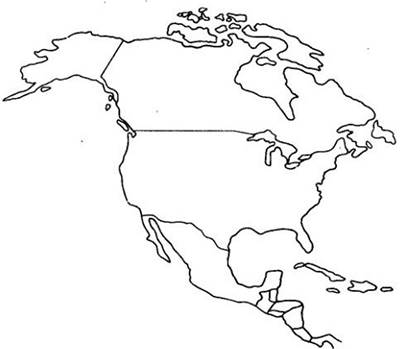
Fig. 32-6. Tropical rain forest in North America. Such forests also occupy parts of Haiti and Puerto Rico in the Caribbean
Tropical rain forests currently occupy approximately half of the Earth's forest area, but they are being systematically destroyed by human activity. Rapid population growth in the tropics, combined with traditional land-use practices, has caused conventional farming Methods—which involve clearing the forest followed by short-term cultivation of the cleared plot—to spread over increasingly vast areas, leading to catastrophic consequences. As a result of this habitat destruction, numerous species of plants, animals, and microorganisms find themselves on the brink of extinction (see Chapter 30).
One of the reasons for the rapid disappearance of tropical forests under human pressure is The Nature of their soils. Many of these soils developed under conditions of consistently high temperatures and heavy rainfall and are relatively infertile. More than half of tropical soils are acidic and deficient in calcium, phosphorus, potassium, magnesium, and other nutrients. Furthermore, phosphorus tends to bind with iron or aluminum to form insoluble compounds unavailable to plants, and toxic concentrations of aluminum are frequently observed here. Roots typically spread within a surface layer no more than a few centimeters thick and rapidly absorb the nutrients released by the decomposition of litter, returning them to the living PARTS OF THE plants. Below this thin soil layer, which is easily disrupted when the forest is cleared, organic matter is virtually nonexistent. Consequently, cultivating tropical soils presents significant challenges, even though the available nutrients immediately following land clearance may be sufficient to yield good crops for two to three years. Yet, tropical forests worldwide continue to be cut down and burned on an increasing scale, primarily to create agricultural fields that become entirely infertile after just a few years. It is estimated that by the beginning of the next century, the majority of tropical rain forests will have vanished from the face of the Earth, surviving only in the western Amazon basin and central Africa.
Savannas and Deciduous Tropical Forests
Savannas are grassland communities (predominantly grasses) featuring broad-leaved deciduous or evergreen trees growing individually or in groves. In some savannas, trees dominate and often grow quite densely, while in others, shrubs prevail. This biome occupies the region between evergreen tropical rain forests and deserts (Fig. 32-7). Savanna trees are typically deciduous, shedding their leaves during the dry season. Savannas cover vast areas of East Africa (see Fig. 32-1) and surround rain forests wherever rainfall is lower and limited to specific seasons. They also occur between prairies and temperate deciduous forests, between prairies and the taiga in North America1, and across much of eastern Mexico, Cuba, and southern Florida (Fig. 32-8).
1 In Soviet literature, physiognomically similar temperate communities are termed forest-steppe. — Ed. note.
Fig. 32-7. Savanna in Kenya with zebras, a giraffe, and an impala. The transitional nature of this biome, situated between the tropical rain forest and the desert, is reflected in the combination of grasses, shrubs, and short trees. Acacias are visible in the Background
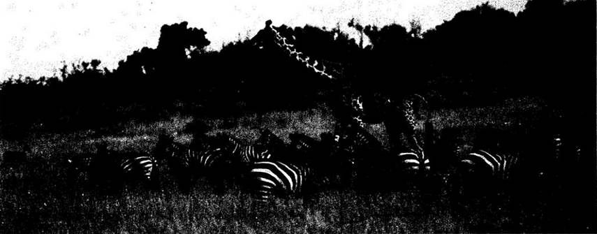
Fig. 32-8. Distribution of savannas in North America

Annual precipitation in savannas is generally much lower than in tropical rain forests, typically ranging from 90 to 150 cm per year. Due to seasonal drought and sparse vegetation, the amplitude of mean monthly temperatures is broader. Dense thorny scrub thickets (cerrado), which cover vast areas of Brazil, are also classified among savannas. As precipitation increases and its seasonal distribution becomes more even, savannas and seasonally similar deciduous tropical and subtropical communities gradually transition into tropical rain forests, which in turn penetrate deep into the savannas in fingers along rivers (gallery forests). Toward the poles, savannas and closely related vegetation types give way to deserts.
Because trees are scattered, the soil in savannas is generally well lit, making perennial grasses (primarily graminoids) common. Bulbous plants capable of withstanding periodic fires are also numerous. Because the abundant seasonal rains foster a dense cover of perennial grasses, annuals are very scarce, and epiphytes are rare as well.
Savanna trees often possess thick bark. They branch profusely but rarely exceed 15 m in height. Nearly all shed their leaves at the onset of the dry season and bloom while bare. Their leaves are generally smaller than those of evergreen rain forest trees, thereby losing less water through Transpiration.
In Southeast Asia, vast areas are covered by monsoon forests (see Fig. 32-1), which resemble savannas in having a distinct dry season. However, the trees grow much more densely here; like the shrubs, they are predominantly broad-leaved and deciduous. Monsoon forests are a particularly widespread type of seasonal deciduous forest, although other types can also be found across various parts of the tropics. Monsoon forests also occur in northern Yucatán, Mexico, and eastern Brazil (see Fig. 32-1). In the regions where they are distributed, heavy rainfall occurs during part of the year, brought by moisture-laden ocean monsoons, but there is also a well-defined dry season during which the trees drop their leaves.
Other types of deciduous and semi-deciduous forests occur in tropical and subtropical regions characterized by seasonal drought. Most of Florida and extensive areas of the southeastern United States are covered by subtropical mixed forests (Fig. 32-9). Pines and other evergreen trees (Fig. 32-10) grow here alongside deciduous species, with precipitation falling primarily in the summer. Tropical mixed forests, featuring a higher proportion of evergreen tree and shrub species than their subtropical counterparts, are found locally in eastern and southern Brazil and northern Australia (see Fig. 32-7). Similar communities of subtropical and tropical mixed forests, woodlands, and scrub are represented in Argentina (see Fig. 32-1).
Fig. 32-9. Distribution of subtropical mixed forests in North America
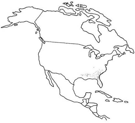
Fig. 32-10. Slash pine (Pinus elliottii), one of the widespread evergreen tree species found in the subtropical mixed forests of the southeastern United States

The existence of African savannas and monsoon forests (Fig. 32-7), as well as those in other regions, depends heavily on periodic fires. Winters here are long and hot, prompting local inhabitants to frequently burn vegetation to stimulate the regrowth of fresh grass for the game they hunt, as well as for livestock grazing.
Deserts
Vast deserts are located in the high-pressure zones flanking the tropics at roughly 30° latitude, and they also extend poleward into the interior of continents (see Fig. 32-1). Rainfall here often drops below 20 cm per year. In the Atacama Desert along the coast of Peru and northern Chile, the mean annual precipitation does not even reach 2 cm. Massive deserts are found in North Africa and the southern part of the continent, where the Namib Desert is home to some of the world's most remarkable organisms, including Welwitschia (see Fig. 18-35). These biomes also occur in the Middle East, western North and South America, and Australia. The world's largest desert is the Sahara, spanning the entire area from the Atlantic coast of Africa to Arabia. The second largest is the Australian Desert, covering about 44% of the continent's landmass. In North America, this biome occupies less than 5% (Fig. 32-11).
Fig. 32-11. North American deserts. The Sonoran Desert extends from southern California to western Arizona and south into Mexico. Some of its characteristic plants are shown in Fig. 32-12, A–C. North of the Sonoran lies the Mojave Desert; one of its typical plants is the Joshua tree (Yucca brevifolia) (Fig. 32-12, D). Here lies Death Valley, featuring the continent's lowest point (90 m below sea level), located just 130 km from Mount Whitney, which rises over 4,000 m above sea level as the highest peak in the contiguous states. The Mojave Desert transitions into the Great Basin, a cold desert nestled between the Sierra Nevada to the west and the Rocky Mountains to the east. Vast expanses of the Great Basin are covered by sagebrush Artemisia tridentata (Fig. 32-12, E) and rabbitbrush Chrysothamnus. East of the Sonoran lies the Chihuahuan Desert.

Many deserts are characterized by extremely high temperatures, often exceeding 36°C in the summer. However, others are much colder; for example, the Great Basin in western North America—situated between the Sierra Nevada, Cascade, and Rocky Mountain ranges—experiences only a few warm weeks during the entire year. Typically, water vapor in desert air, even when relatively abundant, fails to condense due to the intense heat. Because vegetation is generally sparse, heat radiates rapidly from the soil surface at night, resulting in dramatic diurnal temperature fluctuations.
The seasonal distribution of precipitation in desert regions is roughly similar to that of adjacent areas. Closer to the equator, rains fall in summer; closer to the poles, in winter. Between these zones, such as on the plains of Arizona, there may be two annual precipitation peaks and, consequently, two periods of intensive plant growth—in winter and summer—with different species activating during each period. Overall, the seasonal rhythms of desert plants reflect their evolutionary origins: species that migrated from regions with active winter growth retain this pattern in the desert, whereas those originating from areas with summer rainfall continue to actively vegetate in summer, provided sufficient moisture is available.
Annual plants are better represented in deserts and semiarid regions than anywhere else on Earth, both in terms of Abundance and diversity. Due to irregular water supply, perennial grasses here develop under conditions far from optimal and therefore fail to form a dense turf, which typically inhibits the growth of annuals. Thanks to their rapid growth rate, annuals can colonize open spaces during brief periods of adequate moisture. The seeds of these plants are capable of surviving prolonged droughts in the soil, sometimes lasting many years. Once water becomes sufficient again for germination and development up to flowering, they rapidly spring into action.
Relatively few perennial grasses growing in deserts possess bulbs and remain dormant for most of the year. Taller plants are dominated either by succulents, such as cacti, euphorbs, and other characteristic desert species (Fig. 32-12), or by forms with small, coriaceous leaves or leaves that are shed during unfavorable seasons (Fig. 32-12). These leaves typically feature a thicker cuticle and a reduced stomatal density compared to species from less arid regions. Many desert plants have green, chlorophyll-rich stems capable of Photosynthesis while often lacking leaves altogether (e.g., cacti). Many succulents utilize CAM photosynthesis (see Chapter 7), taking up carbon dioxide exclusively at night while keeping their Stomata closed throughout the day. C4 photosynthesis is likely even more prevalent in deserts and other periodically arid, warm habitats than under other environmental conditions (see Chapter 7).
Fig. 32-12. Desert plants. A. Community of the saguaro cactus (Carnegiea gigantea) and barrel cactus (Ferrocactus) in the Sonoran Desert (southern Arizona). B. California fan palm (Washingtonia filifera) by a stream in Palm Canyon (Sonoran Desert, southern California). C. Coastal desert in Baja California (Mexico), which receives most of its moisture from fog; dominated by the cirio tree (Fouquieria columnaris, formerly classified in the genus Idria) and agaves (Agave shawii). D. Yucca brevifolia in the designated national monument area within the Mojave Desert (southern California). E. The Great Basin dominated by sagebrush Artemisia tridentata in the John Day River basin (eastern Oregon).
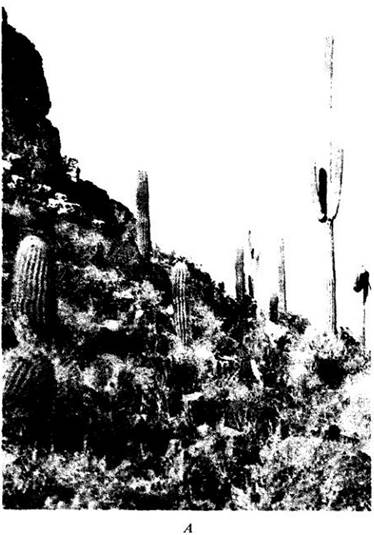

Fig. 32-13. One of the most characteristic plants of the Sonoran, Mojave, and Chihuahuan deserts is the creosote bush (Larrea divaricata). Representatives of this genus in the Mojave Desert can form circular or elliptical clones through the outward growth of new branches at the periphery of the crown as older ones die and break off, resulting in a ring of satellite shrubs surrounding a central bare patch. Sand mounds up to half a meter high typically accumulate in the center, trapping moisture and helping the plants survive during droughts. Some clones can attain a very advanced age. The "King Clone" shown in the photograph is nearly 12,000 years old. Studied by F. Vasek and his colleagues at the University of California, Riverside, these ancient clones originated from seeds that sprouted around the end of the last glaciation.

The temperatures at which photosynthetic rates reach their maximum in desert species are often much higher than those in plants from less arid areas. For example, in the perennial C4 grass Tidestromia oblongifolia, common in the Death Valley region of California and Nevada, this maximum is reached in midsummer under full sun at 45–50°C. The leaves of many desert plants are oriented to minimize heat absorption and may also be densely pubescent for the same reason. Trees and shrubs here either develop a widely spreading ROOT system that efficiently absorbs periodically available rainwater, or concentrate along temporary watercourses (arroyos) that remain dry for most of the year but accumulate moisture when available.
Juniper savannas1, common in the interior western United States (Figs. 32-14 and 32-15), are found within the cold desert zone, typically at higher elevations. During the pluvial (wet) epochs of the Pleistocene, when continental ice sheets reached their maximum extent, such plant communities descended into the lowlands that are now predominantly harsh deserts. Vegetation dynamics here can be reconstructed from dried stems and leaves preserved in ancient packrat middens, as these remains survive exceptionally well in the arid desert air.
1 It is probably more accurate to refer to this as a semidesert. — Editor's note.
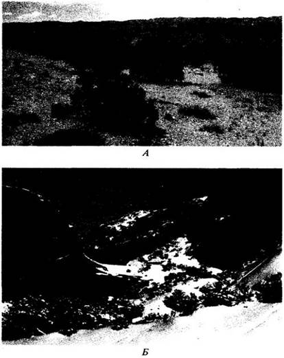
Fig. 32-14. Juniper savanna in North America.

Fig. 32-15. Juniper savanna (featuring Juniperus osteosperma) in the Great Basin near Wellington, Utah. B. Cold winters are characteristic of the pinyon-juniper savannas and woodlands of the Great Basin, as seen in this area south of Moab, Utah.
Steppes
Steppes encompass a highly diverse array of plant communities, some of which grade gradually into savannas, others into deserts, and a few even into temperate deciduous forests. As precipitation decreases toward the equator, the planet's major steppes typically give way to deserts. More productive steppes receive up to 10 cm of annual precipitation and transition into temperate deciduous forests, where moisture availability is even higher. Unlike savannas, steppes lack trees (except for gallery forests along rivers) and are characterized by cold winters.
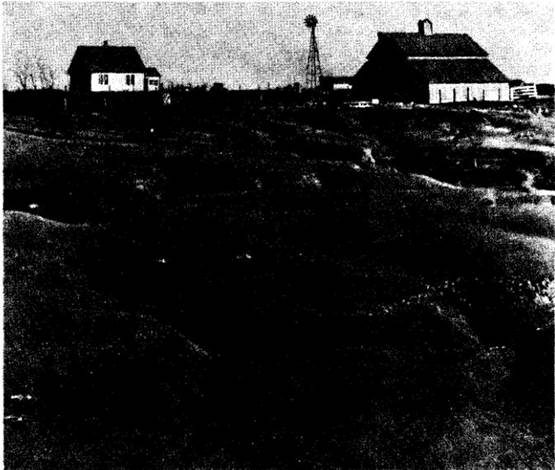
The steppe zone lies between deserts and temperate deciduous forests in regions where precipitation levels fall midway between those typical of the two biomes. When disturbed, steppes frequently undergo desertification or become invaded by trees. A human failure to understand the delicate ecological balance of steppes was the primary cause of the devastating Dust Bowl in the central United States during the 1930s (Fig. 32-16).
Fig. 32-16. Prairie soils were once so densely bound by grass roots that breaking them for agriculture only became possible with the invention of specialized plows. However, once the vegetation is destroyed by overgrazing or improper tillage, these soils quickly erode and blow away in the wind. This photograph of a severely eroded field, taken in Oklahoma in 1937, vividly recalls the dust storms that forced many thousands of people to flee the central United States. The plight of these migrants served as the inspiration for John Steinbeck's novel The Grapes of Wrath.
Steppes have traditionally been subject to intensive human use as pastures and cropland. Considerable effort has been directed toward converting other biomes into steppes, and—once successful—maintaining that state. The most fertile agricultural soils in the Earth's temperate regions are found in areas formerly occupied by tallgrass prairies1.
1 A traditional name for the North American steppes. — Note of the editor.
Steppes typically occupy vast interior expanses of continents (see Fig. 32-1). In North America, they form a transitional belt extending from the arid western shortgrass prairies (the Great Plains) through the wetter and more species-rich tallgrass prairies (the "Corn Belt") to the eastern temperate deciduous forests (Figs. 32-17 and 32-18). Steppes become progressively drier with increasing distance from the Atlantic Ocean and the Gulf of Mexico, which serve as the primary sources of moisture-bearing winds in the eastern North American continent. Moving northward, humidity increases due to reduced evaporation rates resulting from lower temperatures. "Typical" shortgrass prairies develop under nearly arid conditions (Fig. 32-19); in wetter years, tall grasses begin to predominate here (though not as tall as those in the tallgrass prairies). Throughout many forested Regions of the central and eastern United States, particularly on shallow soils, open patches (glades) occur where steppe species are typically well represented (Fig. 32-20).
Fig. 32-17. Distribution of steppes in North America. In addition to the main prairie region in the center of the continent, disjunct areas occur within and around the Central Valley of California and along the Gulf Coast of southeastern Texas and southern Louisiana. The soils of all these regions are highly fertile, possess a favorable structure, and are exceptionally well suited for long-term cultivation.
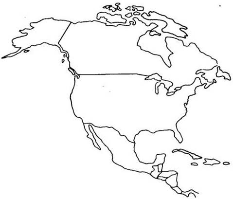
Fig. 32-18. A. Tallgrass prairie in the Flint Hills region (eastern Kansas). This scenic area is proposed for designation as a national steppe park. B. Rolling prairie near Alton (Illinois) dominated by the grass Andropogon gerardi. C. Fertile rolling prairies have been almost entirely plowed, as seen in this corner of Illinois. Here, soybeans (Glycine max) are cultivated in the field.


Fig. 32-19. A. Shortgrass prairie in northeastern Colorado with a young pronghorn antelope (Antilocapra americana). The bluish patches of vegetation are Fringed Sagebrush (Artemisia frigida). Undisturbed shortgrass prairies of this type are dominated by medium-height C3 grasses. B. In overgrazed shortgrass prairies of northeastern Colorado, drought-tolerant C4 grasses become dominant.

Fig. 32-20. The composite Coreopsis dominating a temperate forest glade near St. Louis, Missouri. Such open areas, typically found in regions with shallow soils, are frequently dominated by steppe plants that form dense stands along the forest edge.

Steppes are dominated by bunchgrasses and sod-forming grasses, though perennial forbs are also common. Although the growth of these plants is tied to specific seasons, very little open space remains for annual grasses, and they are generally absent from this biome. On rare occasions, annuals and weeds from other areas establish themselves in disturbed patches, such as around animal burrows, near structures, and along roadsides.
All of the planet's vast steppes were once inhabited by herds of herbivorous mammals and the large predators that preyed upon them. Such animals were widespread during periods of maximum Pleistocene glaciation and served as the primary prey for our hunter ancestors. Many of these herbivores, such as the American bison, have been nearly exterminated. Today, they survive mainly in protected reserves, having yielded their place to livestock herds and cultivated fields.
Temperate Deciduous Forests
This biome is virtually absent in the Southern Hemisphere but well represented in the Northern Hemisphere (see Fig. 32-1). It is best developed in regions with warm summers and relatively cold winters (Figs. 32-21 and 32-22). Mean annual precipitation here ranges from 75 to 250 cm. Deciduousness is likely related to water unavailability during much of the winter due to soil temperatures dropping below freezing. Under such conditions, water uptake by roots ceases. In cold regions with temperate deciduous forests, the ground remains frozen for many months.
Fig. 32-21. The deciduous forests of the southern Appalachians rank among the world's richest temperate forests in terms of tree species diversity. A. Mixed forest with Eastern Hemlock (Tsuga canadensis) in western Tennessee. B. A deep ravine with a rich deciduous forest. C. In autumn, maple leaves acquire a brilliant scarlet hue. D. Several species of trillium (Trillium) stand out among the herbaceous perennials of these forests.
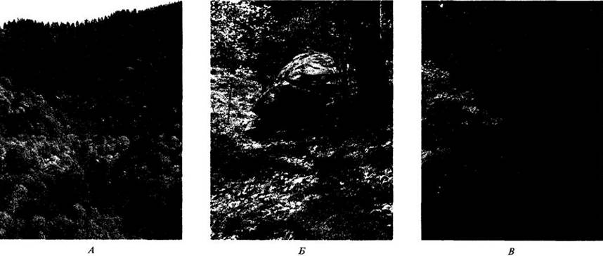
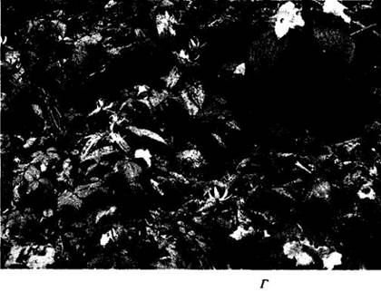
Fig. 32-22. Distribution of temperate deciduous forests in North America.

These forests differ ecologically from evergreen forests in their annual growth cycle pattern (Fig. 32-23). In winter, the trees are leafless, and their metabolic activity is greatly reduced. In spring, a diverse array of herbaceous plants emerges on the well-lit forest floor (Fig. 32-21, D). Before the trees leaf out and light levels beneath the canopy drop sharply, early spring herbs manage to set seed. Annuals are very scarce in deciduous forests, likely due to their lack of storage Organs that allow perennials to develop rapidly during the relatively brief period of abundant light and moisture.
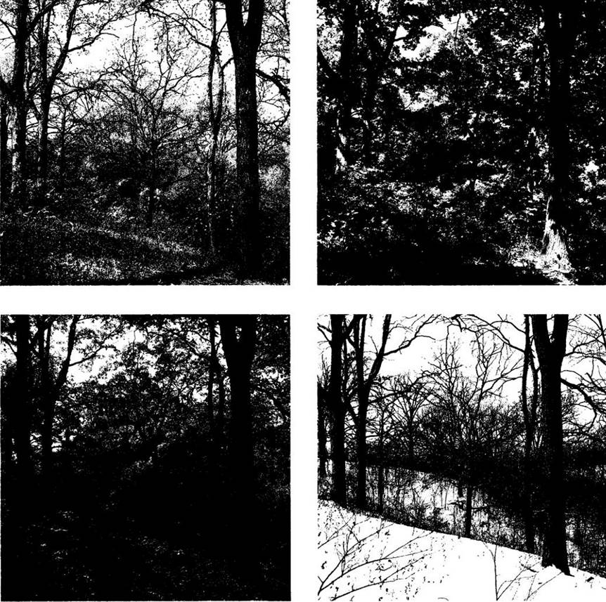
Fig. 32-23. The four seasons in a temperate deciduous forest in Illinois. Trees here produce leaves in early spring, beginning to accumulate nutrients at the same time; in autumn, they shed their leaves and enter a dormant state, in which they remain throughout the unfavorable winter growth period. Numerous herbs grow beneath the trees (see Fig. 32-21, D); some of these bloom in spring even before the full development of tree leaves that subsequently shade the forest floor. In spring, most trees produce abundant pollen. It is wind-dispersed, occasionally landing on the flowers of other individuals of the same species.
Soils in regions with temperate deciduous forests are typically acidic and relatively nutrient-poor; consequently, they easily lose nutrients after clearing and become infertile after a few years of intensive cultivation. Steppe soils are much more fertile and favorable for sustainable agriculture.
One of the most striking features of temperate deciduous forests is the similarity of plants across the three main regions they occupy in the Northern Hemisphere. They frequently belong to closely related species within the same genera. In contrast, deserts in different parts of the globe are typically inhabited by representatives of distinct families and genera that have convergently acquired a set of common morphological and physiological traits (see the Appendix "Convergent Evolution" to Chapter 22). Plants of temperate deciduous forests form a much more uniform complex. For instance, the herbaceous flora of Japanese forests is very similar to that growing in the forests of eastern North America—a resemblance far stronger than that between the floras of either of these regions and the flora of western North America.
Temperate Mixed and Coniferous Forests
In the north, deciduous forests grade into mixed forests, where conifers play a major role alongside deciduous trees. Such temperate mixed forests (Figs. 32-24 and 32-25) are characteristic of the Great Lakes and St. Lawrence River region, much of the southeastern United States, Eastern Europe, the northern and eastern borderlands of Manchuria and adjacent parts of Siberia, eastern Korea, and northern Japan (see Fig. 32-1). They occur in regions with colder winters than temperate deciduous forests, forming a transitional zone between them to the south and the taiga to the north.
Fig. 32-24. Distribution of temperate mixed forests in North America.
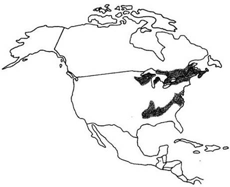
Fig. 32-25. A temperate mixed forest in southern Ontario, Canada, featuring evergreen conifers (dark green) and deciduous trees with autumn foliage.
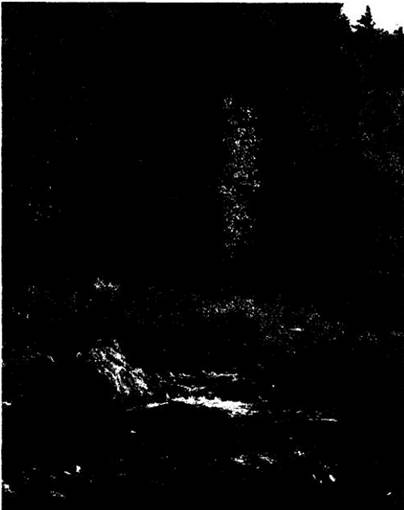
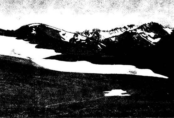
Most deciduous trees and their associated herbaceous plants disappeared from western North America during the latter half of the Cenozoic, as summer precipitation decreased significantly. Today, their place is occupied by montane forests and so-called west coast forests (Fig. 32-26), which include species such as the coast redwood (Sequoia sempervirens, Fig. 32-27), the giant sequoia (Sequoiadendron giganteum), Douglas-fir (Pseudotsuga menziesii, Fig. 32-28), and sugar pine (Pinus lambertiana, Fig. 32-17). All of these were much more widely distributed in the past. Similar vegetation can be found under comparable climatic conditions in Scandinavia, Central Europe, the Pyrenees, the Caucasus, the Urals, southern Tibet, and the Himalayas, extending north to Eastern Siberia. Disjunct patches of analogous forests also occur in western South America, central New Guinea, southwestern New Zealand, the southern Arabian Peninsula, Ethiopia, and the mountains of Central Africa (see Fig. 32-1). At high altitudes here, open herbaceous communities known as alpine tundras develop (Fig. 32-29), interspersed with montane forests throughout the United States, from the Brooks Range in southern Alaska down to the Rocky and Cascade Mountains and the Sierra Nevada range (see Fig. 32-26).
Fig. 32-26. Distribution of west coast mixed forests, alpine tundra, and montane forests in North America.

Fig. 32-27. The coast redwood (Sequoia sempervirens) is a defining element of the mixed forests of the California coast. Nourished by frequent summer fogs and protected from temperature extremes by ocean proximity, redwoods often form picturesque stands, many of which—such as Muir Woods near San Francisco shown here—are now protected in national parks and reserves.

Fig. 32-28. Western coniferous forests in the Cascade Mountains of Washington State, dominated by Douglas-fir (Pseudotsuga menziesii).

Fig. 32-29. Alpine tundra on the Olympic Peninsula, Washington State. In many respects, it resembles the Arctic tundra located hundreds of miles to the north; however, forested slopes are visible immediately adjacent to these alpine meadows.
Mediterranean Scrub
Highly distinctive shrub communities evolved from mixed deciduous-evergreen forests in regions with a Mediterranean climate—that is, characterized by cool, wet winters and hot, dry summers. This climate is typical of the Mediterranean basin, much of California (extending a short distance north and south of it), central Chile, southwestern Africa, and pockets along the southern and southwestern coasts of Australia (see Fig. 32-1). Plants in these regions (often evergreen or summer-deciduous trees and shrubs) have a relatively short growing season restricted to the cooler months when moisture is most readily available. They are capable of efficiently storing nutrients in their evergreen leaves. In a Mediterranean climate, a vigorous burst of spring growth is followed by summer drought and plant dormancy.
Fire is a critical ecological factor in this type of vegetation, having exerted a very regular influence on it long before the advent of humans. Today, wildfires can pose a severe hazard, for instance in southern California, where residential developments encroach deep into the chaparral. In California and western North America generally, chaparral refers to evergreen, often spiny shrubs that typically form dense thickets. Similar vegetation occurs in other Mediterranean-type regions and goes by various local names: *marrish* or *maquis* in the Mediterranean basin, *matorral* in Chile, and *fynbos* in South Africa.
Like deserts, regions with a Mediterranean climate are isolated from one another, and each has developed its own specific flora and fauna. Nevertheless, the degree of ecological convergence is remarkably high, and California chaparral is visually almost indistinguishable from Chilean matorral or European maquis, even though these communities are formed largely by unrelated species. Seasonal drought magnifies The Importance of edaphic (soil-related) and biotic Variability, and subtle differences in precipitation often profoundly affect the lives of the resident animals and plants. Consequently, these regions boast a high proportion of endemic (narrowly localized) PLANT AND ANIMAL species, many of which are currently endangered. These areas have been heavily altered by human activity, and their vegetation often deviates significantly from its original state—for example, featuring more shrubs and fewer trees, alongside an increased presence of spiny and toxic plants driven by livestock grazing.
Taiga
These northern, or boreal, coniferous forests are characterized by a persistent winter snow cover and a harsh climate, especially at higher latitudes. In the southern taiga, trees are tall (often reaching 75 m or more) and robust (Fig. 32-31), whereas in the northern, main expanse of this biome, they are rather stunted; thousands of square kilometers are covered by uniform forests with a relatively low diversity of plant and animal species (Fig. 32-32). The term taiga originated in Russia, where it designates the vegetation of this biome, which occupies a vast area of the USSR, Scandinavia, and northern North America (Fig. 32-32; see also Fig. 32-1). Evergreen trees dominate almost everywhere, except for extensive tracts of northeastern Siberia, which are dominated by deciduous coniferous larches (Larix).
The taiga occurs in the interiors of major continents at appropriate latitudes, with temperature ranges spanning from -50 °C to 35 °C. To the south, it borders on montane forests (e.g., in western North America), deciduous forests, savannas1, or steppes, depending on local precipitation levels. Because large continental landmasses are absent in the Southern Hemisphere, no taiga exists there. Due to the prevailing westerly winds blowing across relatively warm currents between 40° and 50° N latitude, the climate is milder in the western parts of North America and Eurasia than in their eastern counterparts. As a result, the taiga extends much further north along the American Pacific coast than along the Atlantic coast (Fig. 32-33); the same holds true for the distribution of many plant and animal species belonging to this biome. The northern Limits of the taiga are dictated by the severity of the Arctic climate.
1 More accurately, forest-steppes. — Ed. note.
Fig. 32-33. Distribution of taiga in North America.

Across the vast expanses of the northern taiga, most precipitation falls during the summer; in winter, the cold air here holds very little moisture. Annual precipitation is usually less than 30 cm. Evaporation rates are low, giving rise to numerous lakes and bogs. In addition, more than three-quarters of the northern taiga area lies within the permafrost zone, where the frozen ground typically lies less than 1 m below the surface. Despite the low precipitation, the soil remains consistently damp because excess water cannot drain through the frozen layer. The only areas generally free of permafrost are southern slopes, major river floodplains, and the southern fringes of these boreal coniferous forests. Wildfires are common in the taiga; they trigger local thawing of the permafrost, creating warmer, more productive patches that persist for at least the next 10 to 20 years. Overall, taiga soils are highly acidic, nutrient-poor, and poorly suited for agriculture.
Only a few genera of trees are common in the northern taiga: spruce (Picea), larch (Larix), fir (Abies), and poplar (Populus). The most widespread shrubs include raspberry (Rubus), Labrador tea (Ledum), willow (Salix), birch (Betula), and alder (Alnus). Pines (Pinus) can occasionally be found in warm, dry spots. All of these trees and shrubs form ectomycorrhizal associations and create dense stands composed of a single species or very few species. Perennial herbs are common, and mosses and lichens are especially abundant, frequently forming thick carpets. Annuals are almost entirely absent.
At its northern limit, the taiga gradually transitions into tundra. In both of these biomes, days are very long during the relatively short growing period; far to the north, the sun does not dip below the horizon at all during at least part of the summer. Thanks to the abundant light and favorable temperature conditions of this season, cultivated crops such as cabbage (Brassica olerácea) can develop rapidly in cleared taiga areas, reaching a large size in a very short time.
Arctic Tundra
The Arctic tundra is a treeless biome extending to the northern limits of plant distribution (Figs. 32-34). It covers a vast area—nearly one-fifth of the Earth's land surface (see Fig. 32-1). The Arctic tundra is best developed in the Northern Hemisphere, mostly north of the Arctic Circle, although along the eastern margins of continents it extends further south (Figs. 32-35). In essence, together with the alpine tundra—which is more closely tied to adjacent mountain forests and extends southward along mountain chains (see Figs. 32-3, 32-29)—it forms a continuous belt bordering Eurasia and North America to the north. Some plant species of this biome have extensive circumpolar ranges.
Fig. 32-34. A. Arctic wet coastal tundra near Prudhoe Bay, Alaska, in late summer. Reddish-brown plants are the grass Arctophila fulva, and green plants are the sedge Carex aquatilis. Standing water is present on the soil surface due to the underlying permafrost; such conditions are typical of the Arctic tundra. B. Arctic tundra at Barrow, Alaska. A clone of the cotton grass Eriophorum angustifolium growing within a dense sward of another species of the same genus, E. scheuchzeri. Vegetative Reproduction, illustrated here by E. angustifolium, is characteristic of many tundra plants.
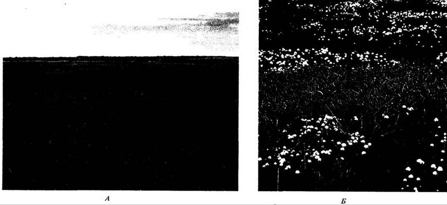
Fig. 32-35. Distribution of Arctic tundra in North America

The Arctic tundra lies entirely within the permafrost zone. Soils here range from acidic to neutral, are nutrient-poor, and are generally poorly suited for agriculture. Although annual precipitation is typically less than 25 cm, most of it remains trapped near the soil surface, keeping the ground wet for the most part. Fixed nitrogen is usually in short supply, and There is a scarcity of legumes and other plants hosting symbiotic Bacteria capable of fixing atmospheric nitrogen. Evaporation is low due to relatively high air humidity combined with low temperatures. However, some tundra regions are so arid that they form true polar deserts or semi-deserts—particularly much of the land north of 75° N, where very few plants exceed 5 cm in height. This is the result of extremely low year-round precipitation and harsh winter temperatures.
For plants to grow at all, the mean air temperature must exceed 0 °C for at least one month of the year. The growing season in many areas of the Arctic tundra is less than two months. Several genera of low-growing shrubs are common here, including birch (Betula), willow (Salix), blueberry (Vaccinium), and Labrador tea (Ledum), along with perennial herbs; among annuals, only Koenigia islandica is found. Many Arctic tundra plants, particularly A number of grasses and sedges, are evergreen, enabling them to initiate photosynthesis as soon as favorable light, moisture, and temperature conditions are established. Plant height depends primarily on winter snow depth; large woody plants are also absent due to their relatively high Respiration rates, which are particularly disadvantageous at low temperatures. Some species bear relatively large, conspicuous flowers requiring a substantial expenditure of energy to produce. Such flowers provide pollinators with high-calorie rewards essential in the cold conditions characteristic of high latitudes. Vegetative reproduction is typical of many perennials, likely compensating for the failure to set seed during years with particularly harsh summers. The bulk of tundra plant biomass (from 50 to 98%) is located underground, comprising not only roots but also rhizomes and other types of subterranean shoots.
North of the Arctic tundra lies the polar ice cap, where physical conditions are even harsher and vegetation is completely absent. Such landscapes are characteristic of the interiors of Greenland, Spitsbergen, and Novaya Zemlya. Most of Antarctica, not shown in Fig. 32-1, is also ice-covered.
Tropical rainforests, where neither moisture nor temperature acts as a limiting factor, represent the planet's biologically richest biome in terms of species diversity. The trees here are evergreen with broad, leathery leaves. The herbaceous ground layer is weakly developed, but lianas and epiphytes are abundant in the higher strata of the community. Tropical soils are often acidic and extremely nutrient-poor, rapidly losing their fertility once the forest is cleared.
Tropical and subtropical communities with pronounced seasonal drought are represented primarily by savannas, subtropical mixed forests, monsoon forests, tropical mixed forests, southern woodlands, and scrublands. All or many of the trees and shrubs within them are deciduous, shedding their foliage during the dry season. Herbaceous perennials are common. Savannas also occur between prairies and temperate deciduous forests or the taiga in the United States and Canada1. Mixed subtropical forests cover much of Florida and the Coastal Plain in the southeastern United States, where evergreen trees, particularly pines, grow alongside deciduous ones. Moving away from the equator, these vegetation types transition into Deserts and semi-deserts, which are characterized by low precipitation and often extremely high daytime temperatures during at least part of the year. Succulents and annuals are common in deserts.
Steppes border savannas2, deserts, and temperate forests; they are devoid of trees except for strips along watercourses. Their soils are among the most fertile for temperate agricultural crops.
1 Referring to forest-steppes. — Ed. note.
2 Also referring to forest-steppes. — Ed. note.
In temperate deciduous forests, most trees shed their leaves during cold (often snowy) winters, when moisture may become unavailable for plant growth. These forests share many tree genera between North America and East Asia. To the north, they border temperate mixed and coniferous forests, where conifers play a prominent role.
Distinctive shrub communities known as chaparral in western North America and maquis in the Mediterranean region have developed in five areas of the world characterized by dry summers and a cool, rainy growing season in winter. In addition to these two regions, this vegetation type defines the Cape floristic region (South Africa), central Chile, and southwestern and southern Australia.
The taiga comprises vast northern coniferous forests stretching in a continuous belt across Eurasia and North America, extending down the Pacific coast to northern California. The southern taiga is dominated by tall trees densely draped in epiphytic bryophytes and lichens, whereas further north, uniform, monotonous stands formed by very few species are typical. North of the taiga lies the tundra, a treeless region also encircling the Northern Hemisphere, predominantly above the Arctic Circle and interrupted only by water bodies. The northern taiga and the entire tundra lie within the permafrost zone, which is why their soils are usually damp despite relatively low precipitation levels.
Appendix 1. Alexander von Humboldt
Alexander von Humboldt (1769–1859) was arguably the greatest scientist-explorer in history. Born in Germany, he extensively traversed the interior of Latin America between 1799 and 1804, ascending some of its highest mountain ranges. While exploring the region between Ecuador and central Mexico, Humboldt was the first to note the incredible diversity of tropical life and, consequently, the first to grasp the sheer abundance of plant and animal species inhabiting the Earth.
During his travels, Humboldt was struck by the tendency of plants to occur in recurring combinations, that is, as components of distinct communities. Moreover, where climate, soil, and biological interactions are similar, analogous plant assemblages emerge. He also discovered a second fundamental ecological principle: the correlation between latitude and altitude. He found that climbing a mountain in the tropics is equivalent to traveling northward (or southward) from the equator. Humboldt illustrated this concept with a well-known diagram of vegetation zones on Mount Chimborazo in Ecuador, which he successfully scaled. Incidentally, this climb took him to the highest altitude achieved by a human up to that time.
Following his return from Latin America in 1804, Humboldt spent eight weeks in the United States. For three of those weeks, he was a guest of Thomas Jefferson at Monticello, spending their time discussing many topics of mutual interest. It is said that Humboldt's enthusiasm for exploring new lands laid the groundwork for Jefferson's grand Vision of the westward expansion of the United States. Consequently, several counties, mountain ranges, and rivers in that part of the country are named in honor of the German naturalist. After returning to Berlin, Humboldt lived for over half a century more, dying in his ninetieth year. He remains one of the greatest writers and scientists of his era.
Appendix 2. Rodent Pollination of Tropical Plants
Complex new Interactions Between Plants and animals in the tropics are continually being discovered. For instance, in 1979, S. Lumer of the New York Botanical Garden described the first documented case of rodent flower pollination in the New World. The accompanying nighttime photograph shows a marsh rice rat (Oryzomus devius) drinking nectar from the flower of the epiphytic plant Blakea chlorantha in a Costa Rican cloud forest. These flowers exhibit several traits associated with the attraction of non-volant mammals: they are inconspicuous, green in color, nocturnal in anthesis, and produce abundant, sucrose-rich nectar. When the rat grasps the flower and inserts its Tongue in search of nectar, an explosive discharge of abundant pollen is triggered from the anthers. The pollen coats the animal's snout, thereby transferring it to the stigma of the next flower visited. Pollination mediated not only by bats, but by other mammals as well, has also been recently documented for marsupials in Australia and South America, lemurs in Madagascar, monkeys in South America, and rodents in Hawaii and South Africa. In all these cases, the flowers were rich in nectar.

Last update: 07/08/2026
Editorial and Educational Adaptation: This material has been compiled based on the primary/original source text. The project team performed an editorial review, corrected technical inaccuracies, structured sections, and adapted the content for an educational format.
What was processed:
- elimination of formatting defects (OCR errors, structural breaks, corrupted characters);
- editorial organization of content;
- standardization of terminology in accordance with academic sources;
- verification of factual statements against the original source text.
All mentions of the author, publication year, and origin of the primary text have been preserved in accordance with the source.