PHARMACEUTICAL BOTANY - 2013
Chapter IV. VEGETATION OF THE ZAPORIZHZHIA REGION
During field excursions conducted as part of the educational and field practice in pharmaceutical botany, students are expected to study, identify, and memorize the plant species growing in the Khortytsia National Reserve.
4.1. General Information about the Khortytsia National Reserve
As the name of the reserve suggests, its territory is centered around Khortytsia Island. Khortytsia Island is a unique historical, cultural, and natural landmark, as well as the largest island in the Dnipro River valley. It is 11.2 km long, up to 2.4 km wide, covers an area of 2329.92 hectares, and has a perimeter of 27 km. In 1958, Khortytsia Island was declared a local-level natural landmark.
In 1965, the State Historical and Cultural Reserve was established on Khortytsia Island.
In 1974, part of its territory was designated as the "Dnipro Rapids" State Geological Reserve, a rocky section of the Dnipro River that includes the southern part of Khortytsia Island, Bayda Island, Stoh-1 and Stoh-2 cliffs, and stone pillars in the lower pool of the hydroelectric power station (HPP). These feature characteristic outcrops of Precambrian crystalline rocks, rupestrian vegetation, remnants of ravine forests, patches of virgin steppes, and Dnipro floodplain lands.
Since 1993, the State Historical and Cultural Reserve has been granted national status.
In addition to Khortytsia Island itself, the Khortytsia National Reserve includes adjacent islands and rocks: Rozstiobin Island, Dubovyi Island, the Blyzniuky Islands, Serednia Rock, Try Stohy Islands, Bayda Island, and the Vyrva tract (on the right bank of the Dnipro River).
The total area of the reserve is 2359.34 hectares.
Khortytsia is a unique natural landmark. The reserve protects valuable natural and territorial complexes, including floodplain forests and meadows, true and petrophytic steppes, rocky granite outcrops, ravines, hanging bogs, and lake systems.
The flora and fauna of Khortytsia are characterized by significant species diversity (accounting for 21% of Ukraine's total flora and 48% of Ukraine's total vertebrate fauna).
Approximately 1,090 species of higher vascular plants have been registered on the island, among which 105 are endemic, 29 higher vascular plant species are listed in the Red Data Book of Ukraine, 11 are included in the European Red List, and 10 plant communities are listed in the Green Book of Ukraine.
Natural vegetation has survived on only 25% of the island's territory. However, due to the lack of a developed park zone in the city and high levels of air pollution, the island is subject to intensive recreational use, leading to the degradation and destruction of plant communities.
Early natural science and educational research on the island was brief and exploratory in nature. Since 2000, however, the biological station of Zaporizhzhia National University has been operating on the island. With the ESTABLISHMENT OF THE Nature Research Department within The Structure of the Khortytsia National Reserve,
these research efforts have become more systematic.
Nevertheless, despite the obvious significance of its historical and cultural monuments, The problem of restoring The Nature of Khortytsia Island cannot be resolved until a complete inventory of surviving valuable areas is compiled and a reliable system for their protection and use is established. In 1995, large-scale geobotanical and landscape maps of the island were created. Currently, issues related to reclamation, surveys, maps of restored vegetation cover, project designs and decisions, and exploratory expeditions are handled by the reserve's staff and specialists, including researchers from Dnipro National University (a report by Assoc. Prof. L.P. Mytsyk on biocenosis restoration on
former agricultural lands) and the Institute of Geography of the National Academy of Sciences of Ukraine, which conducted comprehensive studies commissioned by the Khortytsia National Reserve (including a report and maps of the restored vegetation cover).
The Challenge of restoring the disturbed landscapes of this "pearl" of Zaporizhzhia and all of Ukraine remains pressing. In light of the above, we decided to conduct an inventory of the flora of Khortytsia Island. The research was carried out by the staff of the Department of Pharmacognosy in cooperation with the staff of the Khortytsia National Reserve under the supervision of Associate Professor K.Ye. Koreshchuk, Candidate of Biological Sciences, between 1978 and 1998, and this work is now being continued by her students and followers.
4.2. Physical and Geographical Characteristics of Khortytsia Island
Khortytsia Island. Data regarding THE ORIGIN OF its name are contradictory. Some scientists believe the island was named after the mythical sun god Hors, who was highly revered by ancient Slavs; others suggest the name is related to the island's position between two channels of the Dnipro River and derives from the Turkic word "orta," which translates to "middle" in Ukrainian. The island is elongated from north to south. The part of the island where the Serpent's Cave and the Black Rock are located rises 42 meters above sea level, while closer to the center of the island near Sovutyna Ravine it reaches 58 meters (elevation marks according to available cartographic Materials). In this elevated section of the island, granites outcrop to the surface.
Khortytsia Island lies approximately at 47° 42' N and 37° 05' E. It is part of a general plateau, now surrounded on all sides by the waters of the Dnipro. Individual rocks washed by the Dnipro, as well as Mala Khortytsia Island in the Old Dnipro channel, are detached fragments of the current Khortytsia Island massif.
From a geomorphological standpoint, Khortytsia Island belongs to the Huliaipole accumulative dissected plain, which is part of the Zaporizhzhia Plain.
The relief of Khortytsia Island is characterized by three main elements:
1) an elevated plateau in the central part;
2) steep, precipitous slopes directly adjacent to the old and new channels of the Dnipro River;
3) relatively low-lying areas—floodplains (*plavni*)—in the southeastern part of the island.
The primary landform feature is the plateau, represented in the western part by
flat, elevated areas, transitioning to wide and narrow undulating terrain in the central part, and gently rolling hills in the east. The highest point of the plateau reaches an absolute elevation of 78 m. The lowest relief elevations, close to the level of the Dnipro River, are found in the floodplain areas and along the island's coastline, standing at 16 m above sea level.
The relief of Khortytsia Island was shaped primarily by wind and Water erosion, as well as accumulation processes.
The slope areas are characterized by a certain degree of erosion and a dissected gully-ravine system. The intensity and character of slope development vary across the island. Slope angles range from 5–80° in different locations. The gentlest slopes are observed where the plateau transitions into the floodplains. Steeper slopes are notable along the northern and southern coastlines, where they drop almost sheer to The surface of the Dnipro River.
Ravines and gullies formed on steep slopes exhibit varying degrees of erosion. Their constituent elements include gentle and moderately gentle slopes, as well as steep gullies everywhere overgrown with herbaceous and shrub vegetation.
The main landform features here are deeply dissected sections of the watershed plateau, gently sloping and inclined valley and ravine slopes, and finally, the valleys and ravines themselves, which are well-defined in the topography. The overall surface slope is barely perceptible and trends from the southwest to the northeast.
Groundwater discharges (10 springs) occur at the surface across the island: in Muzychna Balka (Kholodna Krynytsia), between the health resort of the aluminum
plant and the Zaporizhstal recreation center (Kozatska Krynytsia), and in other locations.
The Origin of the island remains not fully understood. It is known that in the section between Dnipropetrovsk and Zaporizhzhia, the Dnipro River flows through a breakthrough valley of tectonic origin. Tectonic disruptions caused increased fracturing of the bedrock, reducing its monolithicity and making it easily susceptible to river erosion.
Geologically, Khortytsia Island is defined as a granite platform capped by a thick mantle of soft sedimentary deposits.
The oldest Precambrian crystalline rocks in our region—granites, gneisses, etc.—are exposed in the coastal cliffs and ravines. These rock outcrops are part of the Ukrainian Shield, specifically belonging to the so-called Zaporizhzhia Massif. The Zaporizhzhia Massif is a complex structure projecting along the Dnipro, bordered on the east by the Kinska and on the west by the Bazavluk synclines; it consists of Lower Archean blocks of the Prydniprovsk series of gneisses and granites within the zone of Late Archean folding.
Quaternary deposits are represented by yellowish-brown and buff loess-like loams, sandy loams, and silty sands of aeolian and deluvial origin. The modern division of Quaternary deposits comprises alluvial sands, ravine deposits, and made ground.
Bayda Island (Mala Khortysia) is geologically analogous to Khortytsia Island.
Geographically, Khortytsia Island lies within the arid steppe zone, in its northern part, within a region of insufficient moisture. The climate is moderately continental, featuring a low-snow, relatively cold winter and a hot, dry summer. The average January Temperature ranges from -5.40 C in the north to -3.80 C in the south (with an absolute minimum of -370 C); July temperatures range from +22.60 C to +23.50 C, respectively (with an absolute maximum of +410 C). The period with temperatures above +100 C lasts for 170 days. Annual precipitation is 350-470 mm, with the highest amounts occurring during the spring-summer period. Snow cover depth averages 14 cm. Under unfavorable climatic conditions between April and June, dry winds (*sukhoviya*) and periodic dust storms occur.
Winds are predominantly from the east and southeast, accounting for approximately 81% of all wind directions. The average wind speed is 4-5 m/s, occasionally reaching 20-25 m/s. The air basin above the island is polluted by emissions from industrial enterprises located on the left bank of the Dnipro River. Significant pollution is felt particularly in areas facing the Aliuminiieva and Kapustianka ravines.
Soil-forming parent materials on Khortytsia Island include loesses, loess-like loams, sandy loams, ancient alluvial sands, and granite weathering products. The soils are predominantly chernozems of varying degrees of leaching.
4.3. Vegetation of Khortytsia Island
Khortytsia is the largest island in the Dnipro River valley and a unique historical, cultural, and natural landmark. It is situated downstream from the Dnipro Hydroelectric Station dam, within a valley deeply incised into the crystalline basement rocks of the Dnipro. The main feature of this territory is the combination of elevated plateau landscapes and the Dnipro River valley. Absolute surface elevations range from 16 m (the water level of the Dnipro, essentially the upper reaches of the Kakhovka Reservoir) to 39 m in the southeastern part of the island, reaching 72-74 m in the center and 58 m in the northern part (meaning the total elevation range within the island reaches 58 m).
Overall, the island's surface is formed by several terrace levels. The diverse relief levels comprising the surface of Khortytsia Island, the presence of loess rocks across most of the territory, occasional surface outcrops of crystalline rocks, and sandy alluvial deposits determine the distribution of the island's varied modern landscape complexes, tracts, and localities, while also influencing its biotic diversity. Thus, the flora isolate of Khortytsia Island is distinguished by significant species
diversity (1,090 species, accounting for 21.9% of the total flora species in Ukraine), along with high representation at the genus (51.6% of all genera) and family (64.6% of all families) levels.
The spatial Location of Khortytsia Island, The properties of its lithogenic basement and relief, and the resulting natural conditions have fostered a unique combination of true, petrophytic, psammophytic, meadow, and shrub steppes, as well as forb meadows within supra-floodplain terraces, humid floodplain meadows, herbaceous floodplain-marsh, shrub, and forest floodplain tracts. Lake landscape complexes are abundant, while the floodplain forests in the extreme south of the island are represented by poplar groves and remnants of oak forests (formerly the Velykyi Luh / Great Meadow). Numerous ravine complexes are widespread across the island, among which several major ravines stand out, preserving partial remnants of ravine forests (*bayraks*) featuring English oak (Quercus robur L.), common pear (Pyrus communis L.), small-leaved linden (Tilia cordata L.), one-seed hawthorn (Crataegus monogyna Jacq.), European white elm (Ulmus laevis Pall.), etc., alongside fragments of forb-grass steppes.
Overall, the landscapes of Khortytsia Island are unique in Ukraine for their rich diversity, which is quite unexpected for such a relatively small area. Furthermore, the preservation of numerous tracts and localities on the island within a major industrial city is uniquely significant.
Currently, according to forestry and land management data, approximately 41% of Khortytsia Island is occupied by agricultural land, 17.6% by artificial forest plantations, and about 25% of its area is covered by natural vegetation.
The natural plant cover of Khortytsia has survived in areas untouched by economic activity, concentrated mainly in the southern, floodplain part of the island and along the coastline. A narrow strip along the shore is occupied by remnants of steppes, shrublands, and ravine (bayrak) forests. A number of ravines with fragments of rare steppe associations have also been preserved. Small patches of meadow steppes and tiny hanging bogs (in areas where groundwater seeps to the surface) can occasionally be found.
The island's vegetation is divided into 7 florocenotic groups: steppe, meadow, granite-petrophytic, forest, bog, aquatic, and ruderal-segetal. In turn, the steppe group is subdivided into the following subgroups: forb-fescue-feather-grass steppe, psammophytic steppe, petrophytic steppe, meadow-steppe, and halophytic steppe. The meadow vegetation includes dry-meadow and floodplain-meadow subgroups, while the forest vegetation comprises ravine-forest, floodplain-forest, and artificial-forest subgroups.
The plant kingdom comprises approximately 250,000–300,000 species of higher plants. According to scientists, about 25,000 of these plant species are currently threatened with extinction, meaning that every tenth species on Earth requires conservation. Special attention should be given to the rare plant species found within the Khortytsia National Reserve. All of them are listed in the Red Data Book of Ukraine, and some are on the verge of extinction. These include: needle grass (Stipa capillata L.), Dnieper feather grass (Stipa borysthenica Klok ex Prokud), Lessing's feather grass (Stipa lessingiana Trin ex Rupr), oak tulip (Tulipa querceiorum Klok et Zoz), granite tulip (Tulipa graniticola Klok et Zoz), green-winged orchid (Orchis morio L.), military orchid (Orchis militaris L.), burnt orchid (Orchis ustulata L.), water chestnut (Trapa natans L.), floating fern (Salvinia natans L.), multicolored bulbocodium (Bulbocodium versicolor Ker.-Gawl), woolly-flower milkvetch (Astragalus dasyanthus Pall.), fern-leaved peony (Paeonia tenuifolia L.), alpine woodsia (Woodsia alpina Bott. S.T. Gray), netted iris (Crocus reticulatus Stev. ex Adam), and Dnieper cymbochasma (Cymbochasma borysthenica (Pall. ex Schlecht.) Klok et Zoz).
The conservation of rare and endangered plant species is an integral part of the broader challenge of protecting, restoring, enriching, and rationally utilizing the plant world. Experience shows that establishing nature reserves is the most effective way to safeguard the Gene pool of rare and endangered plants. However, for the effective
conservation of certain plant species that exist in nature in such small quantities that neither reserves nor botanical gardens can guarantee their survival, alternative Methods of Plant gene pool preservation are being developed.
Based on the inventory of higher plants in the Khortytsia National Reserve, it has been established that the flora currently comprises 1,091 species, including: horsetails — 1 species, polypods — 1 species, spleenworts — 6 species, salvinias — 1 species, cypresses — 5 species, pines — 6 species, ephedras — 1 species, cattails — 1 species, bur-reeds — 1 species, pondweeds — 5 species, waternymphs — 2 species, arrowgrasses — 1 species, water plantains — 2 species, flowering rushes — 2 species, frogbits — 4 species, grasses — 65 species, sedges — 23 species, arums — 1 species, orchids — 3 species, willows — 15 species, walnuts — 1 species, birches — 3 species, beeches — 2 species, elms — 3 species, mulberries — 2 species, hemps —
2 species, nettles — 3 species, sandalwoods — 1 species, birthworts — 2 species, smartweeds — 26 species, amaranths (goosefoots) — 24 species, pokeberries — 1 species, amaranths — 8 species, four-o'clocks — 1 species, purslanes — 2 species, pinks — 52 species, water lilies — 2 species, hornworts — 3 species, buttercups — 34 species, poppies — 14 species, mustards (cabbages) — 67 species, resedas — 1 species, stonecrops — 3 species, barberries — 2 species, saxifrages — 10 species, platanes — 1 species, roses — 62 species, caesalpinias — 1 species, legumes — 51 species, geraniums — 4 species, woodsorrels — 1 species, nasturtiums — 2 species, caltrops — 1 species, flaxes — 4 species, citrus (rue) — 5 species, quassia family — 1 species, milkworts — 2 species, spurges — 8 species, pondweed allies — 1 species, boxwoods — 1 species, pistachios — 1 species, bittersweet family — 3 species, maples — 4 species, horse chestnuts — 1 species, soapberries — 1 species, balsams — 1 species, buckthorns — 1 species, grapes — 2 species, lindens — 1 species, mallows — 5 species, St. John's worts — 1 species, waterworts — 1 species, tamarisks — 1 species, violets — 7 species, daphnes — 1 species, oleasters — 2 species, loosestrifes — 4 species, evening primroses — 3 species, water chestnut family — 1 species, water milfoils — 1 species, aralias — 1 species, mare's tails — 1 species, carrots (celery family) — 25 species, dogwoods — 1 species, primroses — 5 species, plumbagos — 5 species, olives — 7 species, gentians — 3 species, mistletoes — 1 species, dogbanes — 2 species, milkweeds — 3 species, bindweeds — 3 species,
dodders — 3 species, mints (deadnettles) — 70 species, nightshades — 11 species, figworts — 42 species, bignonias — 3 species, broomrapes — 3 species, bladderworts — 1 species, plantains — 5 species, madders — 1 species, honeysuckles — 11 species, valerians — 6 species, teasels — 4 species, gourds — 6 species, bellflowers — 7 species, lobelias — 1 species, asters (composites) — 177 species.
4.4. Granite-Petrophytic Vegetation
In the northern and central PARTS OF THE island along the shoreline, Precambrian crystalline rocks (dating back 2.2–2.6 billion years) come to the surface; their close proximity to the surface determines the primary landscape feature of Khortytsia. These areas are represented by the vegetation of crystalline rock outcrops as well as granite-petrophytic plant complexes, possessing high historical authenticity and supreme aesthetic landscape value (in some places, steep cliffs rise 25–35 meters above the Dnieper River level). The total area of natural rock complexes on Khortytsia is approximately 17.8 hectares, stretching along the Dnieper coastline for 8 kilometers. The Formation of Plant communities here involves, on the one hand, representatives of zonal vegetation, and on the other hand, xerophytic shrubs and sub-shrublets typical of stony habitats.
Crustose Lichens are widespread on exposed rocks, while liverworts and mosses settle in crevices where even a small amount of fine soil has accumulated. In shady spots and rock fissures with northern and northeastern exposure, four fern species grow: brittle bladder-fern (Cystopteris fragilis (L.) Bernh.), common polypody (Polypodium vulgare L.), northern spleenwort (Asplénium septentrionale (L.) Hoffm.), and male fern (Dryopteris filix-mas (L.) Schott.). Fissures filled with fine soil are also inhabited by bulbous bluegrass (Poa bulbosa L.), wall brome (Anisantha tectorum (L.) Nevski), sweet Alison (Aurinia saxatilis (L.) Desv.), yellowish onion (Allium flavescens Bess.), desert alyssum (Alyssum desertorum Stapf.), beaked alyssum (A. rostratum Stev.), and dimorphic thyme (Thymus dimorphus Klok. et Shost.), among others.
Shrubs settle in some of the deeper cracks: Spiraea hypericifolia L., black chokeberry cotoneaster (Cotoneaster melanocarpus Fisch. et Blytt.), dog rose (Rosa canina L.), Bordzilowski's rose (R. bordzilowskii Chrshan.), burnet rose (R. spinosissima L.), and others. At the Base of the cliffs and on certain horizontal gravelly-pebbly scree platforms, A wide variety of plant communities can be observed depending on The amount of fine soil available.
4.5. Forest Vegetation
IDENTIFICATION OF REPRESENTATIVES of various flowering plant families.
A forest is a type of land cover vegetation represented by diverse Morphology/18.html">PLANT LIFE FORMS, among which trees play the leading role. It is an element of the geographical landscape consisting of a community of plants, animals, and microorganisms that are biologically interconnected in their development, mutually influencing one another and their environment. The forest is a crucial Sanitary and hygienic factor that sustains all life on Earth. Forests purify the air, stabilize the atmospheric composition, regulate the intensity of snowmelt and river water levels, preserve beneficial fauna and microorganisms, absorb noise, and provide an ideal setting for recreation and tourism. Forests exhibit strong ecological bonds and possess the capacity for self-regeneration. The forest phytocoenosis is formed by woody and herbaceous plants under the Influence of the physical and geographical conditions of their habitat and may change due to human intervention (alterations in composition, structure, growth, and regeneration).
Forest Types. Forests as Plant Communities.
Forest types: tropical rainforests, subtropical rainforests, sclerophyllous subtropical forests, summer-green deciduous forests, winter-green coniferous forests.
Tropical rainforests are distributed in the humid tropics with annual precipitation ranging from 3,000 to 10,000 mm, and a temperature of about 23 °C that remains nearly constant throughout the year (South America – the Amazon basin, India, Indochina, Indonesia, Equatorial Africa). The main floral representatives are species from the families Myrtaceae, Rubiaceae, Lauraceae, Araceae, Orchidaceae, palms, as well as giant ferns, numerous lianas, epiphytes, and bamboos.
Subtropical rainforests are found in more temperate and less humid zones (Southern China, Japan, New Zealand, Florida, Chile). The vegetation is represented by species from the families Magnoliaceae, Rosaceae, Cupressaceae (tuja), Fagaceae (oak), Cupressaceae (sequoia), with lianas and epiphytes being predominant.
Sclerophyllous subtropical forests are widespread in the arid climates of Australia, South Africa, Mexico, and the Mediterranean region. Plants vegetate under conditions of seasonal moisture deficit, exhibit xenomorphic structural characteristics, and are frequently evergreen. These forests feature plants such as oleander, wild olive, laurel,
eucalyptus, myrtle, juniper, and others.
Deciduous tropical forests occupy the arid Regions of the tropics (Eastern and Southern Africa, Central and South America, Indochina) and are characterized by seasonal leaf shedding. The species composition includes figs, acacias, cassias, and rare timber species (teak, sal, etc.); lianas and epiphytes are sparse.
Summer-green deciduous forests prefer a temperate climate and are characterized by periodic leaf fall. Their distribution zone includes the middle belt of the European part of the CIS, Crimea, the Caucasus, the Russian Far East, and North America. The forests are mixed in composition.
Broadleaved species are represented by the following types:
Pedunculate oak Quercus robur, Oriental beech Fagus orientalis, littleleaf linden Tilia cordata, downy birch Betula pubescens, alder Alnus, aspen Populus tremula, Conifers
genus Fagaceae genus Fagaceae genus Tiliaceae genus Betulaceae genus Betulaceae genus Salicaceae
genus Pinaceae genus Pinaceae genus Pinaceae
Scots pine Pinus silvestris Norway spruce Picea abies Siberian larch Larix sibirica
Lianas
Ivy Hedera genus Araliaceae
Hops Humulus lupulus genus Cannabaceae
Virginia creeper Parthenocissus genus Vitaceae
Schisandra Schisandra chinencis genus Schizandraceae
An understory develops from shrubs beneath the tall trees.
Boreal coniferous forests are widespread in temperate latitudes extending to the forest-tundra zone (they occur rarely in the Southern Hemisphere).
Their species composition is always uniform, meaning one of the coniferous species is dominant. Pine forests, or borrs (Central region of the European part of the CIS, the Caucasus and Crimean mountains), spruce forests (the Caucasus, Central Asia, the north and central regions of the CIS), and fir forests (the Caucasus) are well-known.
Sometimes forests can be waterlogged. The dominant species belong to various genera:
Fir - Abies Spruce - Picea Larch - Larix Pine - Pinus
These forests are also rich in cap Fungi and mosses.
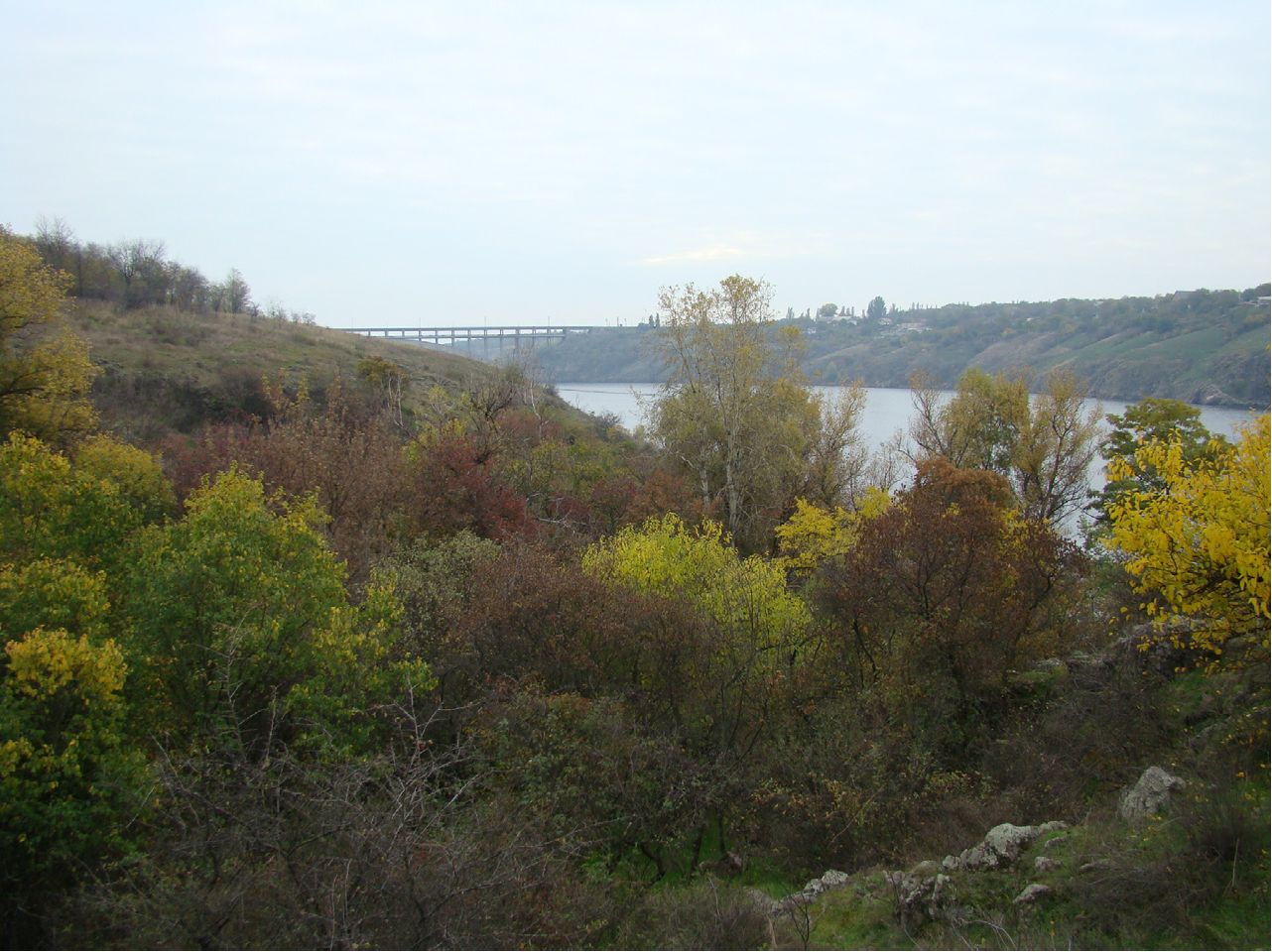
A significant part of the island is covered by forests of both natural and artificial origin. Artificial plant formations are located in the northern and central parts of the island and include deciduous and coniferous stands of various ages. Among the deciduous stands, the primary formations are black locust (Robinia pseudoacacia L.) and pedunculate oak (Quercus robur L.). Coniferous stands are dominated by Scots pine (Pinus sylvestris L.) communities. Native forest associations occupy about 7% of the total area. They are represented by floodplain forests and ravine forest communities.
Natural floodplain forests are found in the southern (floodplain) and northern parts of the island. In the northern part, they are sparse and located mainly as narrow strips along the coast. They exist under extreme
ecological conditions (affected by
a prolonged, regulated regime) and
are characterized by an
anthropogenically flooded structure, thus featuring a relatively simple composition and species
richness. The core of the floodplain forests is formed by communities of coenotically most active species: black poplar (Populus nigra L.) and white willow (Salix alba L.). Among other floodplain forest communities, coenoses of white poplar (Populus alba L.) also occur here. Elm-oak forests grow in elevated sites.
Forest vegetation of the southeastern coast and the southern slope of the island is represented by riparian oak forests of pedunculate oak. Fragmentary floodplains along the eastern coast are dominated by black poplar woodlands with inclusions of willows.
The northeastern and western coasts of the island are dissected by a gully-ravine system covering an area of about 147 ha, which includes more than 18 large and small ravines represented by steppe, ravine, shrub, and artificial forest vegetation.
Ravine forests are located within the coastal gully-ravine system and cover approximately 57 ha. The basis of forest vegetation in the ravines consists of elm-field maple oak groves—the most typical ravine forests of the forb-fescue-feather grass steppe subzone (such as the Hanivka, Velyka Molodnyaga, Sovutyna, Naumova, Heneralka, Shyroka, and Korniyeva ravines, etc.).
Besides pedunculate oak (Quercus robur L.) and field elm (Ulmus carpinifolia Rupp.), ravine forests also feature European white elm (Ulmus laevis Pall.), wild pear (Pyrus communis L.), field maple (Acer campestre L.), European ash (Fraxinus excelsior L.), white mulberry (Morus alba L.), and black mulberry (M. nigra L.), among others. Along with arboreal vegetation, the ravines harbor understory shrub species, including Tatar maple (Acer tataricum L.), one-seed hawthorn (Crataegus monogyna Jacq.), wild privet (Ligustrum vulgare L.), European spindle (Euonymus europaea L.), glossy buckthorn (Frangula alnus L.), purging buckthorn (Rhamnus cathartica L.), and others, The Diversity of which is determined by the soil and climatic Features of the gully-ravine systems. Most of Khortytsia's ravine forests belong to secondary forest types; having undergone repeated logging, they have survived to the present day due to the capacity of native tree species for coppice regeneration and their resistance to forest fires. Consequently, the floristic diversity of Khortytsia's ravine forests often resembles that of oak-hornbeam forests, whereas mature oaks occur sporadically or are present only as undergrowth.
The herbaceous cover of the ravines features a pronounced spring synusia, specifically: Buche's star-of-Bethlehem (Ornithogalum boucheanum (Kunth) Aschers.), oak tulip (Tulipa quercetorum Klok. et Zoz), Siberian squill (Scilla sibirica Haw.) and two-leaf squill (S. bifolia L.), solid-tubered corydalis (Corydalis solida (L.) Clairv.), Marshall's corydalis (C. marschalliana Pers.), Paszoski's corydalis (C. paszoskii N.Busch.), Russian fritillary (Fritillaria ruthenica Wirstr.), lily of the valley (Convallaria majalis L.), fragrant Solomon's seal (Polygonatum odoratum (Mill.) Druce), and others, which in such habitats can serve as indirect indicators of the phytocenosis's incomplete degradation. In summer, due to heavy canopy closure, the herb layer is less developed; occasionally, one may encounter birthwort (Aristolochia clematitis L.), orchard grass (Dactylis glomerata L.), ground ivy (Glechoma hederacea L.), sweet violet (Viola odorata L.), wood avens (Geum urbanum L.), greater celandine (Chelidonium majus L.), and others.
A strip of ecotonal shrubs lies between the ravine forests and the steppe vegetation, comprising common barberry (Berberis vulgaris L.), warted spindle (Euonymus verrucosa Scop.), blackthorn (Prunus spinosa Scop.), various hawthorn species (Crataegus L.), St. John's-wort-leaved spiraea (Spiraea hypericifolia L.), Russian bush-clover (Caragana frutex (L.) C.Koch), etc. Notably, St. John's-wort-leaved spiraea (Spiraea hypericifolia L.) extends far beyond the tree canopy, forming independent communities—patches of shrubby steppe that hold significant scientific value because they harbor floristic elements of petrophytic, true, and meadow steppes: Ruprecht's stonecrop (Sedum ruprechtii (Jalas.) Omelcz.) and biting stonecrop (Sedum acre L.), Russian houseleek (Sempervivum ruthenicum Schnittsp. et C.B.Lehm), steppe timothy (Phleum phleoides (L.) Karst.), dropwort (Filipendula vulgaris Moench.), lesser meadow-rue (Thalictrum minus L.), dwarf iris (Iris pumila L.), willow-leaved fleawane (Inula salicina L.), panicled baby's-breath (Gypsophila paniculata L.), early sedge (Carex praecox Schreb.), and others.
4.6. Urban Ornamental Plantings
Urban vegetation is one of the forms in which the modern biosphere exists. Green spaces mitigate summer heat and air dryness, protect against strong winds, and help increase air ionization. The noise-dampening
effect of woody plants is well known, associated with the sound-reflecting capacity of leaves (about 75%), as well as their ability to filter the air by absorbing dust and various chemical pollutants. Plants absorb up to 60% of toxic gases from the air, whereas atmospheric moisture accounts for up to 20%, and water bodies and animals for up to 5%. Therefore, plants collected near industrial enterprises, along busy roads, or simply on city streets—where the concentration levels of toxic substances in the air and soil are highest—should not be used for food or medicinal purposes.
Urban plants inform people about environmental and air pollution, acting as bioindicators. For example, when sulfur dioxide levels are elevated, the leaves of deciduous trees begin to turn pale and brown; conifers show needle reddening; and in gladioli, exposure to fluorides causes the tips to die off first, followed by the entire leaf.
Urban plants also play a significant cognitive role. Many of them possess ornamental properties, belong to edible or medicinal species, and have been introduced into landscaping As a result of Introduction and acclimatization.
Later, the acclimatization of ornamental plants was pursued by scientific societies, commercial enterprises, and amateurs alike. Some scholars view cities as a distinct "Urbs ecosystem" with its own species composition and specific soil-climatic conditions.
The specific and challenging nature of urban environmental conditions affects such vital processes as growth rate, seasonal development pace, flowering intensity, Photosynthesis, and Respiration. Photosynthetic processes are slowed down, which is explained by a decrease in chlorophyll content within METABOLISM/14.html">Chloroplasts and the clogging of stomatal pores.
Local plant development is also negatively impacted by insufficient soil moisture, increased air dryness, leaf overheating, and the disruption of stomatal integrity due to pollution. However, not all plants suffer from these harsh environmental conditions. Smoke- and dust-resistant species are chosen for landscaping industrial areas, such as eastern cottonwood (Populus deltoides), black poplar (Populus nigra), western arborvitae (Thuja occidentalis), and eastern redcedar (Juniperus virginiana); less resistant species include black locust (Robinia pseudoacacia), Lombardy poplar (Populus nigra 'Italica'), Norway maple (Acer platanoides), littleleaf linden (Tilia cordata), and northern red oak (Quercus rubra); among shrubs: wild roses, spiraeas, golden currant, etc.
Nowadays, There is a range of green infrastructure designs aimed at a rational approach to solving landscaping problems in urbanized territories. The most common types of urban plantings include city parks, small squares, gardens, boulevards, linear street plantings, etc.
Plants are given their shape and original decorative appearance through pruning and trimming. Trimming is performed to give a tree a specific shape, silhouette, etc. Pruning is carried out to create continuous linear masses. All these measures lead to disrupted plant growth, a sharp reduction in leaf mass, and a weakening of the Organism's vitality.
Modern landscaping practices demand species and generic diversity of plants, along with the search for new hybrids, cultivars, and forms. Tree species that match the local soil and climatic conditions are used for landscaping homes, architectural ensembles, streets, squares, parks, and alleys.
Vining plants—such as Virginia creeper, Dutchman's pipe, ivy, hops, and roses—are used for the vertical landscaping of walls, arches, alleys, and gazebos. Mesh arches or metal frameworks in the form of columns, pyramids, and figures are used to support them.
Small trees (such as narrow-leaved maple, Crimean linden, and arborvitae) are planted along pathways near entrances, while shrubs (such as roses, mock oranges, lilacs, spruces, and arborvitaes) are grown in planters.
The best species for protective greenbelts near schools are English walnut, wild cherry, western arborvitae, linden, and oak.
According to N.A. Khokhno, about 170 species and ornamental forms of trees and shrubs grow in the natural and artificial phytocenoses of Zaporizhzhia's green zone, accounting for less than 10% of the species
diversity of introduced plants and native dendroflora in Ukraine. Among the recorded plants, 26 species and forms are conifers, and 143 species and forms are deciduous.
The woody plants used in landscaping belong to 34 families and 76 genera (with the number of species/forms indicated in parentheses): Ginkgoaceae - Ginkgo (1); Cupressaceae - Juniperus (3/5), Platycladus (1/2), Thuja (1/3); Pinaceae - Abies (1), Picea (2/2), Pinus (3), Pseudotsuga (1), Larix (1); Taxaceae - Taxus (1); Aceraceae - Acer (6/3); Anacardiaceae - Cotinus (1), Rhus (1); Betulaceae - Alnus (1), Betula (1); Bignoniaceae - Catalpa (2); Buxaceae - Buxus (1); Berberidaceae - Berberis (3/2), Mahonia (1); Caprifoliaceae - Viburnum (2/1), Lonicera (3/1), Sambucus (2), Symphoricarpos (1), Weigela (2); Caesalpiniaceae - Cercis (1), Gleditschia (2), Gymnocladus (1); Celastraceae - Euonymus
(2); Cornaceae - Cornus (3); Corylaceae - Corylus (1), Carpinus (1); Elaeagnaceae - Elaeagnus (2), Hippophae (1); Fabaceae - Robinia (1/2), Sophora (1), Amorpha (1), Caragana (2), Laburnum (1); Fagaceae - Quercus (3/1); Grossulariaceae - Ribes (3), Grossularia (1); Hippocastanaceae - Aesculus (1); Hydrangeaceae - Hydrangea (1), Deutzia
(3), Philadelphus (1); Juglandaceae - Juglans (3); Magnoliaceae - Magnolia (1); Moraceae - Morus (1/1); Oleaceae - Fraxinus (3/2), Forsythia (3), Syringa (3), Ligustrum (1); Paeoniaceae - Paeonia (1); Platanaceae - Platanus (2); Rosaceae - Amygdalus (1), Armeniaca (1), Cerasus (2), Crataegus (3/1), Malus (1), Padus (2), Sorbus (3/1), Chaenomeles (1), Pyrus (1), Cotoneaster (3), Physocarpus (1), Rosa (3), Sorbaria (1), Spiraea (5); Salicaceae - Populus (8/1), Salix (5/1); Simaroubaceae - Ailanthus (1); Tamaricaceae - Tamarix (2); Tiliaceae - Tilia (4); Ulmaceae - Ulmus (3), Celtis (1); Vitaceae - Parthenocissus (2).
Among the green spaces, the highest number of utilized species and ornamental forms belongs to the genera Populus, Acer, Salix, Spiraea, and Juniperus, whereas quantitatively, the most widespread plants in the plantings belong to the genera Robinia, Populus, Ulmus, Acer, Aesculus, Tilia, and Spiraea.
Last update: 07/08/2026
Editorial and Educational Adaptation: This material has been compiled based on the primary/original source text. The project team performed an editorial review, corrected technical inaccuracies, structured sections, and adapted the content for an educational format.
What was processed:
- elimination of formatting defects (OCR errors, structural breaks, corrupted characters);
- editorial organization of content;
- standardization of terminology in accordance with academic sources;
- verification of factual statements against the original source text.
All mentions of the author, publication year, and origin of the primary text have been preserved in accordance with the source.